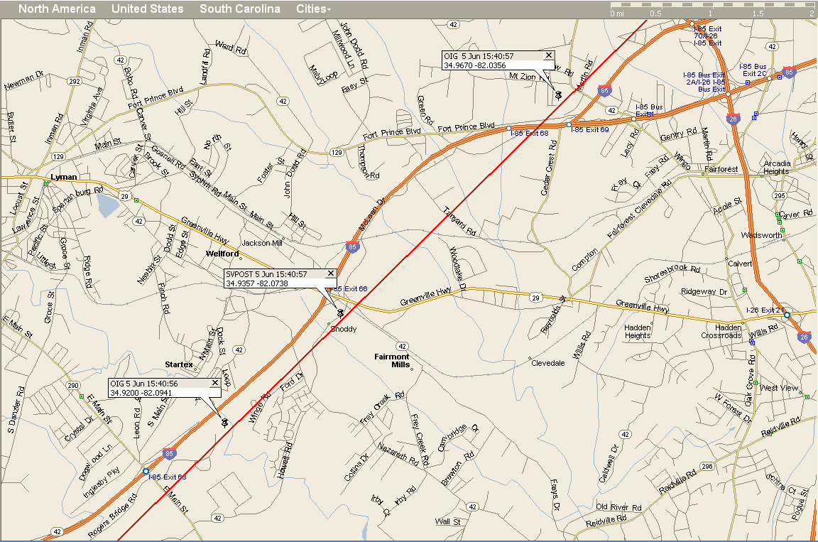
I entered latitude = 34.9357 / longitude = -82.0738 (corresponding to SVPOST 15:40:57) as my site location at www.calsky.com, which tells me that it computes the centerline as being .47 km = .29 mi to the southeast of my track. A possible source of the discrepancy is that I use the WGS '72 geodetic model, while CalSKY uses WGS '84 (it's unclear what Microsoft Streets & Trips uses!).
I'd be interested in seeing comparison predictions by SkyMap, STK, The Sky, etc.
| Time | Object | Event |
|---|---|---|
| Observer Site | User Site, United States Geographic: Lon: 277d55m34.3s Lat: +34d56m08.5s Alt: 205m WGS84: Lon: 277d55m34.3s Lat: +34d56m08.5s Alt: 205m All times in EST or EDT (during summer) |
|
| 15h40m56.9s | Crosses the disk of Moon. Separation:0.05d Angular Velocity:54.6'/s. Transit duration: 0.56s Angular diameter: 9.5" cylindrical, 20.0m x 10.0m Direction towards center line: 0.47km, az:128.8d SE az: 105.3d ESE h: 53.9 dist: 483.6km mag=-0.5m |